

It has been nice to see some sunny, warmer days over the past several days after a very wet and cold winter. Temperatures around 17 and 18 degrees were most welcome. Rainfall for August at 176mm was 62% higher than the long-term average of 102.7mm. Total Winter rainfall of 483mm was 55% higher than the long-term average.
Much of Victoria has seen very good rainfall over winter boosting root zone moisture. This is the level in the soil that supports most plants with moisture. Southern parts of Victoria had average or above average soil moisture levels as shown on the 29th of August posting on the Bureau of Meteorology web site. Large parts of north-eastern Victoria currently have above average soil moisture levels while far eastern Victoria has below average moisture levels having missed out on some of the good rains.
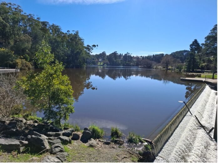
Around our Shire many areas are very wet as can be seen with large pools of water lying in paddocks. The overflow at Lake Daylesford is running strongly. For the first eight months of this year Daylesford has had 805mm of rainfall well above the long-term average of 496mm.
Daylesford’s Water reservoirs continue to be 100% full and overflowing. Melbourne’s reservoirs are 69.1% full compared to 72.2% this time last year. Across Australia water reservoirs are 70.4%, 3.6% higher than last year. New South Wales has missed out on much of the heavier rains and their reservoirs are only 56.8% full.
For some months the Bureau has been forecasting El Nino conditions developing which usually result in drier conditions for the eastern portions of Australia. Their latest forecast advises that El Nino is firmly established, is likely to be strong and will persist into autumn 2027.
The diagram from the Bureau’s web site, below, shows the Bureau’s assessment based on several models. The brown areas covering Victoria and Tasmania indicate that rainfall is expected to be well below average. Other parts of eastern Australia are expected to have lower or close to average rainfall. The western half of the continent is forecast to be wetter than normal except for far south-western, Western Australia.
Chance of Above Median September to November – as of 20th August BOM

The Bureau forecasts that day and night temperatures are likely to be higher than average. This is likely to result in fewer and less severe frosts. We did see a few frosts a couple of weeks ago and it will be interesting to see if we get many over coming weeks as early spring historically can regularly see frosts. The snow fields in Victoria and New South Wales had less snowfalls again.
Melbourne has officially had its warmest winter since records began in 1855, 171 years ago. The Age newspaper report on Wednesday quotes the Bureau of Meteorology’s latest reporting. Across Australia, averaged-mean winter temperatures were 1.45 degrees above the 1961-1990 average which is the third highest since national records began.
With the tragic landslide and flooding in Nepal and Tibet there are international efforts to help deal with the devastating impacts. Scientists are already assessing and investigating the likely causes and there are likely to be a number of contributing factors. One key issue is the impacts of global warming which can result in melting within glaciers. Combining with other factors such as heavy rains or earthquakes can trigger such events. Here in Australia we need to better understand how we are adding to impacts on climate and environment.
With the wet winter there is likely to be lots of vegetation growth as the temperatures increase. The forecast drier conditions into Summer are likely to result in greater fire risks as the vegetation dries out. The CFA and others are encouraging people to prepare for these risks. Some valuable information can be found on the CFA web site: