
All the talk lately of the possibility of blocking traffic on Albert Street brings to mind some of the incidents in the past where streets have been altered in some way. The first that comes to mind is Vincent Street, which up to the 1860s was blocked at Raglan Street. Blocked is not quite right, it was just not continued. It was stopped short by the natural ground level at this spot. All the traffic to Hepburn was channeled up Jamison Street and connected by Richmond Street which branched off near Westwood Street and joined the road to Hepburn near to where Hepburn House is now.
When it was decided to extend Vincent Street it became Vincent Street North which it is to this day (as far as I know). Later I suspect this new name affected even the post office and the odd and even house numbers swapped sides.
Camp Street is a good example of a street being altered to the dismay of some and the great inconvenience of others, in this case the Albert Hotel.
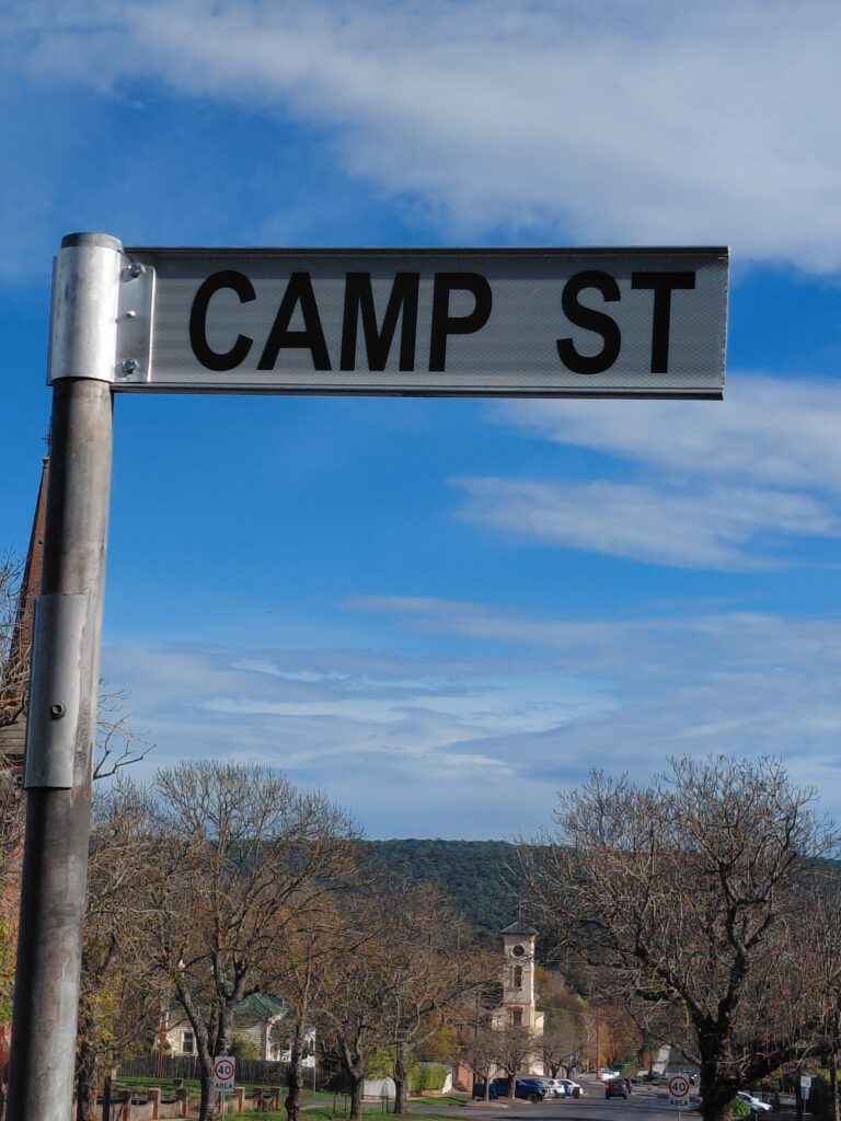
Today you can plainly see the houses, the Courthouse the Police Station and the church all perched up at the height of the old road before hundreds of tons of earth were dug out and used to fill the west side of the street. This caused problems for the hotel as the loose spoil covered the lower floor windows where it remains today. It was also responsible for the metal hand rail that guards the drop to the ground floor of the Hotel. The present footpath was once a set of stairs with a handrail but at some time they were asphalted over although you can still see the end of a bluestone step jutting out in the gap to the building.
Albert street finished at West Street and became Albert Lane, and Albert’s partner Victoria became Victoria Lane, also at West Street. Central Springs Road sprung into life when the Council decided to open a Hydrotherapy Centre at Central Springs below Lake Daylesford. This doomed project at the beginning of the Depression resulted in the premature name change, the Hydro facility being at the end of Fulcher street.
This part of the town was also affected by more roadworks when Parkers Hill was cut down to the present level. Many have travelled through the cutting between West and Perrins Street without knowing about George Parker and his large house on the corner of West Street. Parker was a real estate agent and named his house Denver and this area became Parkers Hill.
Streets that have vanished:
Church Street…between Raglan and Hill Street, now railway yards.
Prohasky Street…named after the Hungarian patriot William Prohasky who had a store on the corner of Bridport and Albert. This street ran from Knox street opposite the Farmers Arms Hotel to the Castlemaine road.
Wellington Street…from King Street near Jubilee Lake Road joined in to West and Perrins Streets. Now mostly under the lake.
Closing Albert Street: To my mind one of the ugliest intersections in Daylesford, a monument to cars and asphalt. We can find our way to the Tyre Service by the many other options and the retention of public space is a different subject.
I would love to see a pocket of green jungle on this corner, flowers and greenery, and in a few years we’ll be happy to see it flourishing.
Les Pitt is a Daylesford local with a long and distinguished association with the Daylesford Museum and Historical Society