Victor Szwed
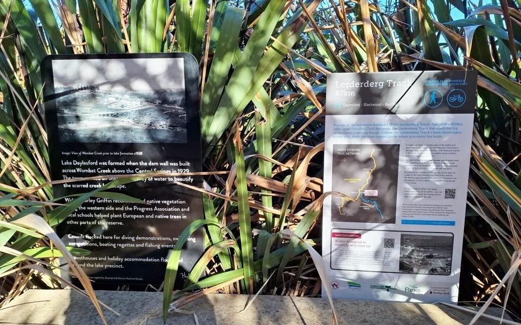
Take a walk down to the Bridport Street side of Lake Daylesford and have a look at the interpretive sign for the Lerderderg Track. Learn about this 87 kilometre track which runs from Daylesford through Blackwood to Bacchus Marsh.
The Lerderderg Track is a shared use track for walkers, runners and cyclists. A separate route for cyclists is defined in areas that are sensitive or unsuitable for them.
The Great Dividing Trail Association (GDTA) members have worked tirelessly for many years to develop not only this track but also the Goldfields Track which runs 214 kilometres from Mount Buninyong south of Ballarat, through Creswick, Daylesford and Castlemaine, all the way to Bendigo.
The Lerderderg Track was upgraded and refurbished by the GDTA about five years ago thanks to a generous grant from DEECA. And last year, the GDTA installed interpretive signage along the length of the Lerderderg Track covering the first contacts with the local Aboriginal people and the interesting people, places and history along the way.
A map covering the whole of the Lerderderg Track is available from the GDTA website. GPS files can also be downloaded which cover both the walking track and the cycling track. More information can be accessed on the GDTA web site www.gdt.org.au or by scanning the QR code on each of the signs.
You do not need to walk all the 87km to Bacchus Marsh as you can do sections of the track from either end or at points along the way. Have you walked Lerderderg Gorge just near Bacchus Marsh? A great place for experienced walkers.
Always plan your walk, take water and food and do not walk alone in unfamiliar territory. Let someone know where you are going as there have been walkers who became lost because of inadequate planning. Be aware of weather conditions and, in the summer, take careful note of Fire Danger Ratings.
A pleasant, comfortable walk is possible along the start of the Lerderderg Track from the interpretive sign at Bridport Street to Cornish Hill, then to Jubilee Lake across the old rail bridge. Yes there was a rail line running from Daylesford Station, across the spillway at Jubilee Lake and on to Ballarat. This line closed in 1953 as cars became the main mode of travel. Have a rest at Jubilee Lake and then amble back to Daylesford.
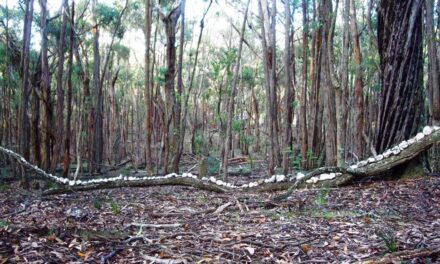
Further along the Lerderderg Track there is plenty of history and many points of interest. Where the Track meets the Werribee River, the Anderson Brothers timber tramway was once the longest in the Wombat Forest. The Balt Camp at Camp Road housed refugees after the Second World War to work as cheap labour in forest management. The track continues to Blackwood, past many gold mining sites and other sites which can be explored further thanks to the interpretive signage along the way.
The GDTA value the support of their volunteers and members. You can join the GDTA via their web site. Your modest subscription and involvement can be very rewarding.
The GDTA acknowledge the traditional owners of the lands which the Lerderderg Track traverses: the Dja Dja Wurrung, Wadawurrung and Wurundjeri Woi Wurrung peoples.
Related Stories:
Chinese Camps and the Goldfields Legacy at Lake Daylesford
Anzac Day: A Time to Remember Those Who Served and Those Who Remained at Home
Victor Szwed is a Daylesford resident and avid bushwalker. This article is one of a series of articles that Victor has contributed about interpretive signage around Daylesford and Hepburn Springs.